The map shows the track we followed for the flights on the day.
As mentioned above our flight took us south over the city CBD and then west to Piha where we did a couple of orbits taking photos' before
heading north up the coast to about level with North Shore Airfield and then back inland to the airfield.

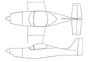
This is the Slingsby that the North Shore Aero Club has for flight training. Quite a purposeful looking machine. Chris tells me the Slingsby
is or was used for primary flight training in the USAF.

This is the panel of the Slingsby. Fairly standard layout for a trainer but quite comprehensive none the less.

After taking off from North Shore we headed south over the Auckland CBD and Chris let me have a bit of a fly to get a feel for the aircraft. This
photo shows yours truly doing the pilot thing (well I'd like to think so anyway) with Devonport, the Waitemata Harbour and Auckland CBD off to the
forward starboard quarter.

We turned in over the city centre and I got this photo of two of Auckland more famous landmarks, the Sky Tower and the Auckland Harbour Bridge.

Back out to the west of the central city this is one of the many dormant volcanic peaks which dominate the skyline in Auckland. This one is
Mount Eden.

From the CBD we headed out West to the coast and I took the next few photo's out from Piha beach. This is the coast line to the north of Piha as
we banked round to get some shots of Piha itself.

This photo is of the Piha beach community with Lion Rock prominant in the fore-ground. This beach and the rocks to the south are somewhat
notorious in New Zealand for the number of people who are drowned here every year. Being a west coast beach, the surf and rips can be extremely
treacherous and many people get into trouble here every year. The surf life savers do numerous rescues every day during the peak of summer
as the beach attracts lots of visitors because of its close proximity to the city. Fishermen like to fish off the rocks to the south but rogue
waves often break over the rocks and wash them off.

This shot is a close up of the rocks to the south end of Piha beach.

We headed north from Piha to start making our way back to the North Shore airfield. I took this photo further along the coast of one of the shear
cliff faces with the surf breaking up against it. This is a fairly rugged part of the coast line and not to be taken lightly if boating or fishing
in these waters. Shortly after taking this shot and slightly further up the coast we turned back inland and headed back to North Shore Airfield.

